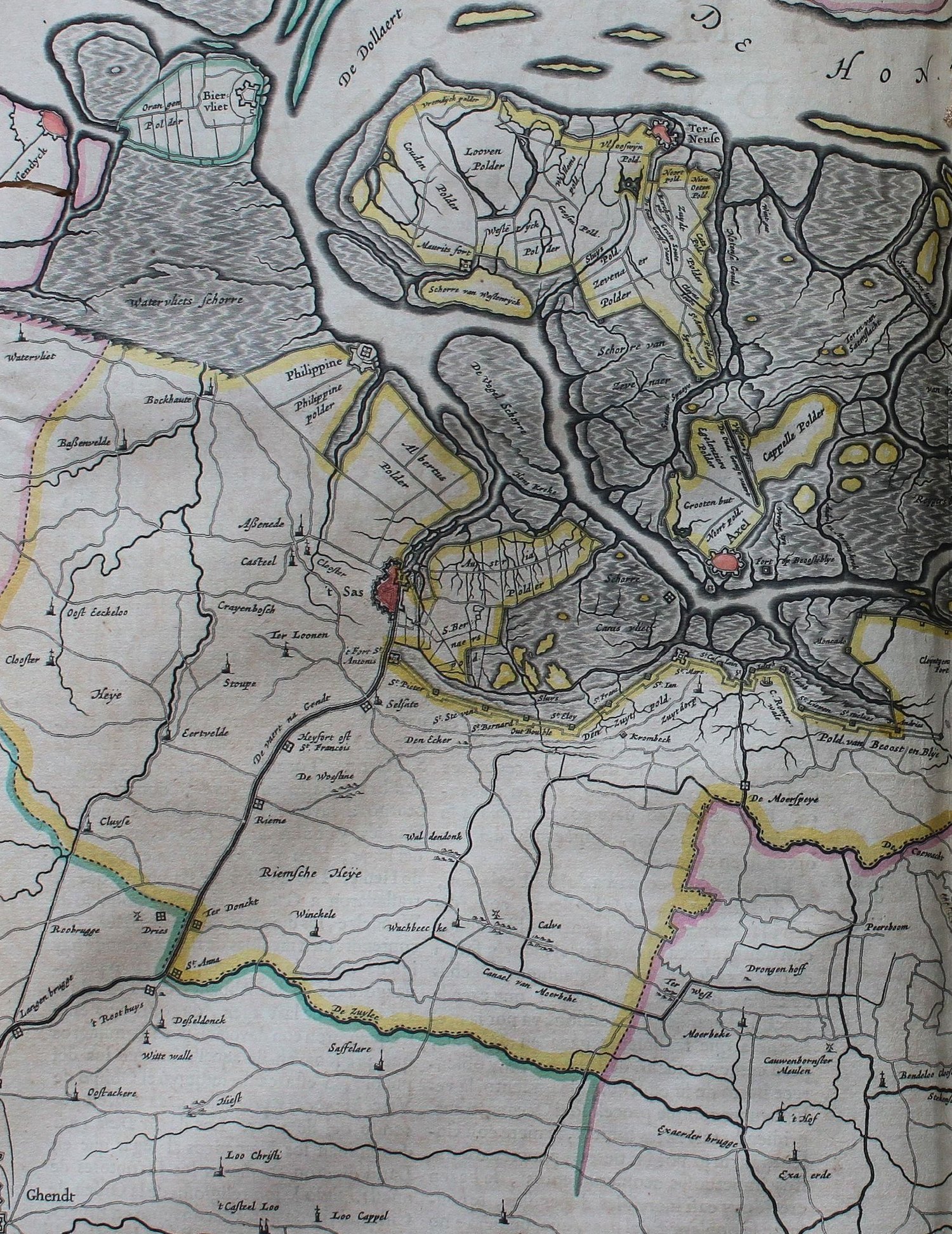
The family's whole country in 1659, four years after Livinus Saij married at Sleidinge. Ghent is at the bottom left, with Kluizen ('Cluyse'), Ertvelde, Rieme and Desteldonk above it, then Assenede, Bassevelde and Boekhoute, and at the top the great grey inland sea the mapmaker labels 'De Dollaert' — the Braakman. The hatched grey is drowned land. The neat new fields marked 'Albertus Polder', between Assenede and Philippine, are the Sint-Albertpolder, diked in 1612, where Joos Saey was farming in the 1630s.
Gerard Coeck, 'Kaerte van de Vier Ambachten', in Joan Blaeu, Geographia Blaviana (Amsterdam, 1659). Scan by Fondo Antiguo de la Biblioteca de la Universidad de Sevilla, CC BY 2.0, via Wikimedia Commons.