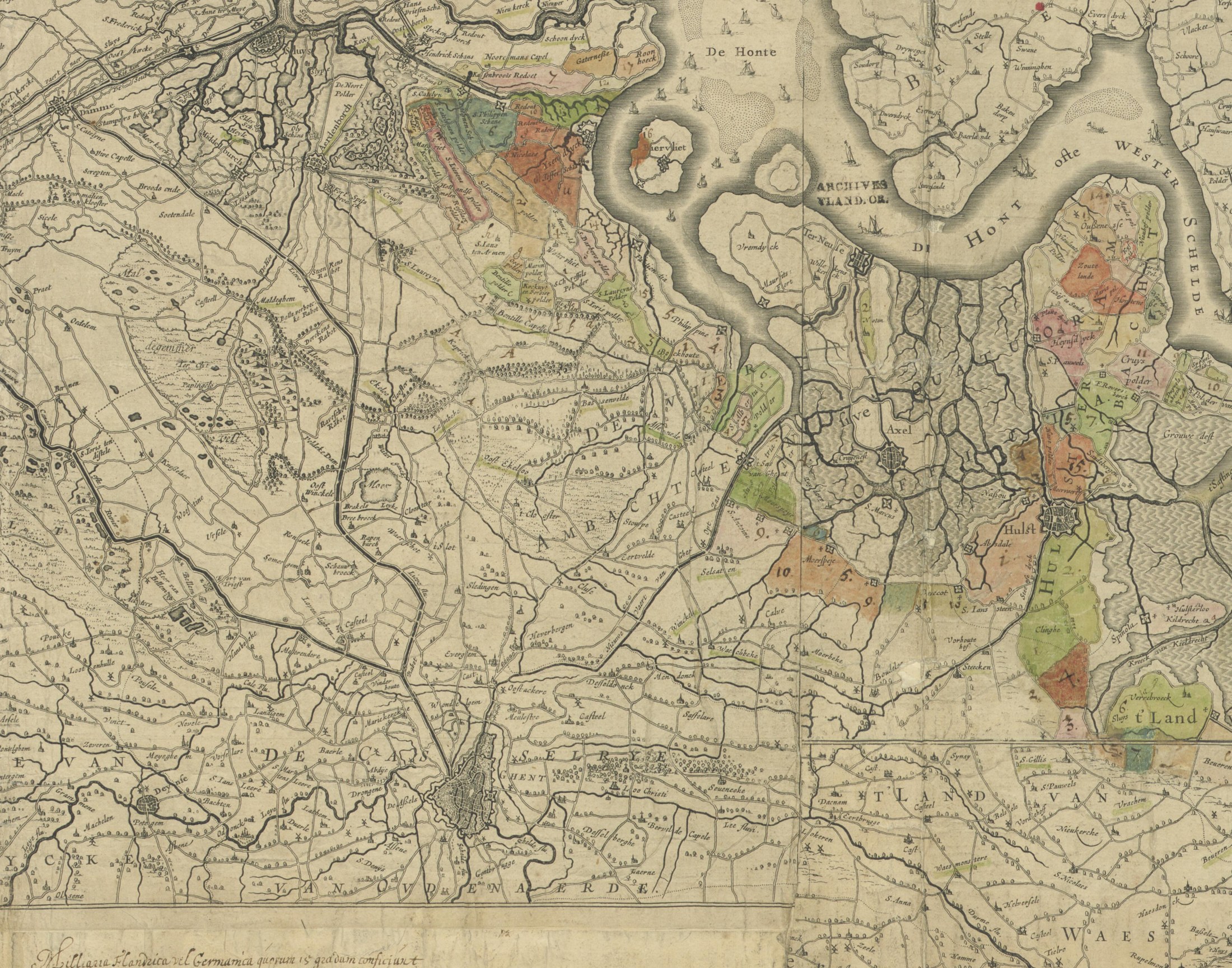
Every place of the Saeij story on one sheet, from a seventeenth-century copy of the printed map of Flanders: Ghent and Destelbergen at the bottom, Sledingen, Evergem, Oostackere and Loo Christi, then Kapricke, Oost-Eekloo, Bassenvelde and Assenede, and at the top the coloured polders reaching to Oostburg and IJzendijke
Manuscript copy, 17th century, after the map of Flanders printed at Ghent by Alexander Serhanders, 'Desumpta ex nova totius Flandriae comitatus descriptione' (public domain). State Archives of Belgium (Rijksarchief Gent), AGATHA 514_0549_000_00021_000.